Sloat Restoration through Managed Retreat

Sloat Restoration through Managed Retreat
This is our original vision for Sloat Restoration - graphic courtesy of PSA and Associates and the Ocean Beach Task Force

Our Vision of Beach Restoration and Preservation

The shorelines of Ocean Beach south of Sloat Blvd and Sharp Park in Pacifica are threatened by rip-rap seawallls and long-term erosion. This blog chronicles our campaign efforts to restore these beaches. Check out the web view of this site to see our proposed solutions and how to help- in the right hand column below. For all the latest about our efforts, see our monthly posts.

We advocate a managed retreat strategy to restore both Ocean Beach south of Sloat and Sharp Park.

At Sloat, our vision involves:

A long-term plan to relocate threatened infrastructure
(including the south of Sloat Great Highway, the two oceanside parking lots and the sewer lines underneath them).

The cleanup of all the rock and rubble littering the beach.

The use of sand dunes as the primary tool to slow erosion.

For Sharp Park, we advocate the decommissioning of the golf course, the removal of the rip-rap berm, and a full restoration of the wetland.

Tuesday, November 27, 2012

CRSMP Public Workshop Recap

The new sand dune at Sloat. photo: Ian Leggat
The latest CRSMP meeting in Pacifica featured a major presentation on the science of coastal erosion in our region. What was particularly revealing was the future projection of shoreline locations as the effects of sea level rise take hold. A lively discussion took place about how communities may respond.

The informational document released for the meeting is called Your Coast In 50 Years Thankfully, it is still available for public review and input.   If you haven't yet, please read over and submit comments. Send them to Athena Honore SFEP/ABAG Outreach & governance ahonore@waterboards.ca.gov. What is clear from the data is that coastside development, our beaches and shorelines are all imperiled. Serious planning needs to commence if we are to respond effectively. Please lend your voice to need for beach preservation and the preferred use of managed retreat wherever possible.  Thanks for staying engaged!
 

Saturday, November 10, 2012

Upcoming Meeting for Peninsula Sand Management Issues

The beach at Mussel Rock in Daly City - lost by a rock revetment that protects a former landfill. Sites like this will be under discussion at Wednesday night's meeting of the CRSMP


Greetings Surfriders and Friends,

The Coastal Regional Sediment Management Plan (CRSMP) has a public meeting scheduled for Wednesday November 14th in Pacifica.  Coastal Erosion and sand replenishment issues will be discussed for San Francisco, Daly City and Pacifica.  Public participation and feedback is most welcome.  If you can make it, please register. RSVP is requested (see below). Surfrider is calling for the use of managed retreat along our coastlines whenever feasible - especially on publicly held coastal lands.  Erosion and sea level rise are not going away.  With managed retreat, we can best preserve our beaches and avoid endless sand replenishment projects.

Speaking of which, in the wake of Superstorm Sandy, the issue of sand replenishment and coastal erosion response is now on center stage. Hopefully, citizens and public officials alike are asking hard questions as the rebuilding process gets underway. Does it make sense to rebuild everything, in all locations - even beaches and boardwalks on sand spits and low lying barrier islands?  If so, who should pay for it? Does everyone recognize that another storm like Sandy can easily hit the coast again sometime in the near future, triggering similar levels of damage?

Sandy brings up questions and issues all people that live on developed coastlines should seriously consider.  Coastal Managers know that storms, beach erosion, sea level rise and flooding are a fact of life for shoreline communities. Surfrider urges the public to take note of the natural processes of our waves, waters and beaches, and to integrate that knowledge into development practices that strike a more balanced, sensible approach with the environment.

Below is the invite to the CRSMP meeting...
------
Hello,

You are invited to a workshop on the Coastal Regional Sediment Management Plan for the San Francisco Littoral Cell (Fort Point, SF, to Pedro Point, Pacifica). The meeting will be held from 5-8pm in Pacifica (540 Crespi Drive, Pacifica Community Center Card Room). The goal of the meeting is to inform and educate the public about coastal hazards, allow municipal and landowning agencies to present some of their preferred alternatives for consideration, and hear input from the public. A read-ahead packet of material will be distributed and posted online later this week.

Please RSVP to me so that we can estimate attendance.

More information about the meeting and the CRSMP process can be found at http://www.sfestuary.org/projects/detail.php?projectID=58 . If you have any questions, you’re welcome to contact me.

Thank you,
Athena

Athena Honore
Communications Officer
San Francisco Estuary Partnership
Association of Bay Area Governments
1515 Clay Street, Oakland CA 94612
Phone: 510-622-2325 / Fax: 510-622-2501
www.sfestuary.org

Tuesday, October 2, 2012

Sand Replenishment Complete

The new sand berm at Sloat


Dear Surfriders and Friends,

The sand replenishment project is complete. Two robust sand dunes have been constructed in the erosion area. Safe access is finally restored (at least temporarily) for both the north and south parking lots.  Again, thanks to SFPUC, SFDPW and the NPS for working together to make this happen. The erosion committee will continue to advocate for non-armoring solutions at Sloat until a long term plan is in place.

Speaking of the long term plan, SPUR is presently laying the groundwork for the pull-back of the Great Highway.  While this is a critical piece to the restoration effort, Surfrider believes it is equally important to reach a decision (and begin to take action) on the Lake Merced Tunnel.  As we all know, powerful winter storms keep their own schedule. Addressing the fate of the tunnel - and doing so quickly - will best help us avoid new erosion emergences.

Thanks again for checking in.  Do stay tuned for new developments including the upcoming regional sand management meetings. 

Thursday, September 6, 2012

Hazardous Debris Removed!

The new sand project will bury all of this and more.
(Photo and August Site Check: Ian Leggat)


Greetings Surfriders and Friends,

We have great news to report: Some of the worst of the hazardous debris at Sloat has been removed from the beach. As many of you probably know, the sand replenishment work is in overdrive building safe access to the water just in time for our Fall surf season.   Thanks to all those in our community who showed up at July's sand management meeting or sent letters to government officials supporting this action. Also, thank you SFPUC, SFDPW, and NPS for listening to our concerns.  This kind of communication and cooperative action is exactly what we were hoping to establish thru the Ocean Beach Master Plan.  Do stay tuned for new developments this fall as there will be plenty of new opportunities to weigh in on public projects slated for our beach.

Surfrider and others from our community have been advocating that this kind of debris be removed before the sand drop.

Monday, July 23, 2012

Major Sand Replenishment Project Coming to the Sloat Area


The Workings of a Dynamic Beach…

A dynamic beach is always in flux.  Sand erodes and accretes (builds up) on a continual basis.  Here is an example: The photo at the top is of Ortega Street from June 2011- midway through incoming tide. The photo on the bottom is the same exact spot, at approximately the same tide, but one year later...When it comes to erosion threats to the Great Highway, Sloat is unique. Accretion processes have failed to regenerate the beach.

Dear Surfriders and Friends,

At the sand management meeting the other night, we got a look at the details of the new sand replenishment project being coordinated by NPS, SFPUC and SFDPW. It is scheduled to start in August; and will deliver significant quantities of sand to the south of Sloat area. The material will be excavated from the beach in front of the O'Shaughnessy seawall (Stairwells 1-21). The measure should help to alleviate the problem of sand accumulation on the road and parking lots at the north end of Ocean Beach. The preliminary cost estimate approximately $700,000. See NPS website for more info. There will be short term closures of some of the parking areas to make this happen. The south bound lanes of the Great Highway will also need to be closed during construction. The project is due to be completed by early September.

The end result will be two separate large sand dunes on the beach, one covering the area just south of 1st parking lot and the other at the south end of 2nd lot. The dunes will be approximately 30-40 in width, effectively burying any rock or rubble in the area where they are placed.

Surfrider generally supports this measure as a temporary measure to improve access to the beach. However, it should be emphasized that this is not the sustainable long term solution forged by the Ocean Beach Master Plan. Most of this sand is projected to wash away at some point. That being said, the project will improve access, aesthetics, and should help to some degree in avoiding new erosion emergencies that bring rock armor onto the beach.

Our chapter continues to call for the removal of rubble and concrete debris already littering the beach. Previous posts have illustrated the point that much of this debris has drifted away from the bluff and is poised to enter the surf zone.  We hope to see some kind of work on this issue before the sand is placed. By removing; or at least re-aligning the debris back onto the bluff, more beach area will be available when the sand erodes. This would help delay wave contact with the rock, thus forestalling the erosive effects of wave scour and backwash.

Thanks for checking in. Please do stay tuned for further developments and information!


Saturday, July 14, 2012

Important Sand Management Meetings Continue...


Rubble at the Erosion Hotspot: 
Please support clean-up of this junk at Tuesday night's meeting!


Dear Surfriders and Friends,

The GGNRA, PUC, and DPW are having a public meeting to discuss the new sand management policy that will result in sand being trucked from the north end of the beach down to the erosion area south of Sloat. Surfrider has been advocating rubble clean-up and maintenance to accompany the sand drop...
Email from GGNRA below...

Public Meeting

The public is invited to meet with project staff and learn about the upcoming Ocean Beach Sand Management project.

Tuesday, July 17 6:00 - 7:30 pm
United Irish Cultural Center Board Room, Third Floor
2700 45th Avenue (at Sloat)
San Francisco, CA 94116
(Parking is available on site)

Project Background: The National Park Service, in cooperation with San Francisco Public Utilities Commission and San Francisco Department of Public Works, will soon begin the Ocean Beach Sand Management project, which will gather excess sand built up in front of the O'Shaughnessy Seawall and place it in the erosion hotspot south of Sloat Boulevard. Shoreline changes along Ocean Beach are dramatic and are a result of natural and human-caused factors.

In general, the beach at the northern end of Ocean Beach has been widening and accumulating sand while the beach south of Sloat Boulevard has experienced a loss of beach and is eroding. Excessive sand at the northern end of Ocean Beach this season has resulted in sand covering the O'Shaughnessy Seawall and accumulating in the parking lot and the Great Highway. This has buried stairways and impeded access along the esplanade. Currently, the sand is in excess of 13 feet deep at the face of the seawall, and is at historic levels of accumulation.

Project Details

The proposed project involves excavation of approximately 100-150 thousand cubic yards of sand from in front of the O'Shaughnessy Seawall from Stairwell 1 to 21, and transporting sand with dump trucks along the Great Highway to the erosion hotspot south of Sloat Boulevard. The sand placed south of Sloat Boulevard will be monitored to understand how long the sand will remain in place, how well it functions as bluff protection, and where it moves in the near shore environment. Project staging will require short-term closures of some parking areas including the parking area at Stairwell 28 and the parking lot located at Sloat Boulevard. The south bound lanes of the Great Highway will be closed during construction hours - Monday through Friday between 8:00 AM and 7:00 PM. No night or weekend work will occur. The project is estimated to be completed within five weeks from the start of the project.

Project Objectives

Remove sand from in front of the O'Shaughnessy Seawall in order to reduce future sand maintenance efforts;

Maintain public access on promenade and stairwells that have been blocked by sand build-up;·        

Enhance beach access in the erosion hotspot area south of Sloat Boulevard;·        

Provide for bluff protection in high risk areas that threaten CCSF infrastructure;·        

Reduce the need to implement more engineered bluff protection measures in the short-term.  For more info about the meeting contact:

Jean Marie Walsh
Communications Manager
1155 Market Street
San Francisco, CA 94103
Office: (415) 554-3203 Cell: (415) 606-6055
jwalsh@sfwater.org
============================================================== 

In other news...

The other night was the public meeting for the Coastal Regional Sediment Management Plan.  Some folks may be wondering if there are duplicate efforts afoot to solve the erosion issue at Sloat.  The Ocean Beach Master Plan is an overall guidance or vision document for improvements to the entire Ocean Beach shoreline area including Sloat . The sand management meeting above is about a new specific DPW program to  use sand at north Ocean Beach for the Sloat hotspot. The CRSMP considers all erosion hotspots in our region, and the role of sand management.

 The CRSMP region spans the entire stretch of coast from the Golden Gate to Pedro Point. The reason behind having a larger scale management plan for sediment management is due to the interconnectedness of sand transport systems along our coastline.  Sand from the San Francisco bay system does generally migrate southbound along our coastline.  Due to human development (daming of our rivers, infilling of our bay, armoring of our coastlines, etc), there is less sand reaching our beaches.  Less sand in the system means more beach erosion.  The CRSMP is about gathering the best science available on our sediment  systems and identifying viable solutions for beach erosion. Ultimately, coastal governments will have to choose which methods they will implement in response to erosion.  With the CRMSP, a much more informed choice is likely to occur.  Surfrider supports the use of sand as beach replenishment as a short term or interim step to maintain a beach.  In most cases, managed retreat is our preferred solution to erosion conflicts along our coastline.

Thurs. night's meeting was excellent, although unfortunately attendance was sparse. The good news is that everyone is welcome to review the material online and still sumbit public comment.  Here's the info: http://www.sfestuary.org/projects/detail.php?projectID=58 .. and do stay tuned. There will be more public meetings on tap.  For Pacifica and Daly City residents, the CRSMP meeting is still scheduled for this Thursday 7-9pm Pacifica City Council Chambers 2212 Beach Blvd. in Pacifica.

Tuesday, July 3, 2012

OBMP Final Released / CRSMP Workshops Upcoming

Sand Ladder Access at the Sloat Muni Turnaround

Dear Surfriders and Friends,

The Ocean Beach Master Plan final is officially now released and ready for download.  A press conference will be scheduled shortly.

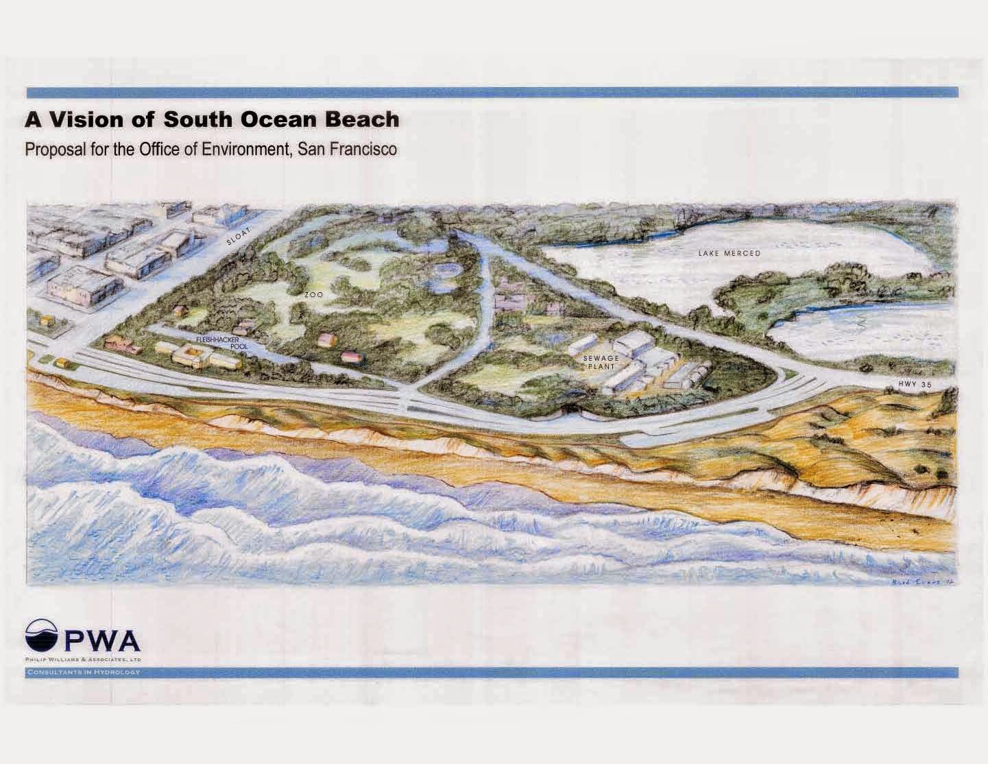
Again, the next step in getting a long term plan for the South Sloat area will involve a feasibility study of the SPUR recommendation.  Surfrider, Save the Waves and others will advocate for a thorough analysis of viable options, including the re-route or relocation of the Lake Merced Tunnel (the piece of infrastructure at the heart of the armoring policy at Sloat).  Please continue to voice your support for a truly sustainable solution that will restore our beach!  You can help by writing letters to media outlets, political leaders, agency leaders as well as just spreading news and updates throughout the general community.

One noteworthy development is the announcement of a series of workshops involving erosion and sand management for the entire Bay Area coast.  The Coastal Regional Sediment Management Plan (CSRMP) is seeking public input on how to use sediment or sand to address erosion hotspots from San Francisco down to Pacifica.  As you may know, sand re-use will be a key component in restoring the South Sloat stretch of the beach.  We also see it as a preferable interim measure while a Managed Retreat plan can be developed.  There are similar armoring and beach loss issues just to our south in which sediment management will play a key role.  Please try to attend these meetings and stand up for long term, sustainable beach preservation strategies.  Surfrider believes there are many opportunities to use Managed Retreat along the coverage area of the CRSMP.

------------------------------------------------------------------------

Public Input Needed for Coastal Erosion Plan, San Francisco to Pacifica

Developing a Coastal Regional Sediment Management Plan (CRSMP)

The Association of Bay Area Governments and the Coastal Sediment Management Workgroup invite the public to provide input on a Coastal Regional Sediment Management Plan being developed for Fort Point, San Francisco, to Point San Pedro, Pacifica, at two identical meetings to be held in July, 2012. “Regional sediment management” refers to sand.

These meetings will:

Describe erosion issues affecting ocean beaches and coastal infrastructure, such as parking lots, highways, structures, storm drains, and sewage outfalls·       

Present implementation options (proposed solutions such as beach nourishment, multi-purpose reefs, armor, allowed erosion, and managed retreat) and concepts for a regional plan and solicit public comments on plan concepts.  See website for more info: http://www.sfestuary.org/projects/detail.php?projectID=58


SF Region:

Thursday, July 12, 6:00-8:30pm

SPUR 2nd Floor Public Assembly Hall
654 Mission Street, San Francisco
Exhibition opens at 6:00, meeting begins at 6:30
 
 
Daly City/Pacifica Region:
Thursday July 19 7-9pm
City Council Chambers 2212 Beach Blvd.  Pacifica, Ca
Additional public meetings will be held in the fall to gather public input on the completed draft Plan.


If you have any questions, please contact me.

Thank you,

Athena
 
Athena Honore
San Francisco Estuary Partnership

Association of Bay Area Governments (ABAG)
1515 Clay St, Suite 1400
Oakland, CA 94612
Phone 510-622-2325  Fax 510-622-2501

sfestuary.org

Learn about solutions to Bay issues: http://www.sfestuary.org/podcast/

Monday, June 18, 2012

Tombstones and Scouring at 2nd Lot

(left) 2nd Lot Shoreline Erosion / Sloughing Debris


Dear Surfrider Friends and Supporters,

Recently, there has been a good bit of media attention regarding the appearance of tombstones at Ocean Beach. In our newly published document The History of Coastal Erosion at Ocean Beach, we note that in1942, a large quantity of debris from the Laurel Hill cemetery was used to patch an erosion hotspot on the Great Highway at Rivera St. Not just headstones, but chunks of mausoleums were piled together to form a giant revetment - not unlike the one we have at Sloat today. According to local historian Woody LaBounty, the bodies of the deceased were first transferred to Colma - so we should be safe from seeing any skeletons popping up from the sand. Here are a pair of newspaper articles about the tombstones:


USA Today ttp://www.usatoday.com/tech/science/environment/story/2012-06-02/cities-flee-ocean/55348992/1

Huffington Post http://www.huffingtonpost.com/2012/06/07/san-francisco-gravestones_n_1579388.html

In other news...


There is a noticeable amount of beach scour at the moment below the second parking lot area. Additionally, new erosion was found of the bluff face itself. It appears that last month’s winds and swell energy have taken their toll. Also, a good deal of the construction rubble seems to be migrating away from the bluff and into the surf zone. See photo on this post. According to Bob Battalio, P.E. , coastal engineer at ESA and Associates, the rubble itself is probably not migrating into the surf zone, but rather it appears to be doing so because of a "sloughing process." This occurs when wave run-up strips sand from underneath an armored revetment. As sand is scoured away, the beach drops in elevation.  This causes rock material to slough downward, sinking into the wet sand. The revetment structure begins to flatten out, spreading over more area as it loses both its height and shape. As the high tide line encroaches, some of the rock will eventually remain submerged, creating underwater hazards. This process appears to be occurring at different areas along the armored shore. We have followed up with government agencies in the hope that some of this rubble may get cleaned-up or at least reconfigured landward during this summer’s sand replenishment effort.


Friday, June 1, 2012

Sand Replenishment Returns!


Sand cleared from the Great Highway makes its way to south Sloat.

Dear Surfriders and Friends,

We have great news to report.  After talking with SFDPW and PUC,  we have gotten word that sand now being recovered from clearing the Great Highway and the O'shaughnessy Esplanade area will be trucked down to the erosion area south of Sloat. See SF Examiner. Additionally, SFPUC is set to work with other agencies over the next several months to ensure this kind of sand management action occurs much more regularly and without delay.

We applaud the City for this kind of action. This sand would have normally been pushed right back onto the beach.  Instead, it will now be used to cover some of the construction debris south of Sloat.  Some of it will also be used for building a sand ladder access to the beach.  While the amount of sand recovered will be fairly modest, and will eventually get washed away, it  does bring much needed relief to the Sloat area shoreline.  We hope this scenario will highlight the need to embrace a sustainable long term plan asap.

On that front, we are still awaiting the schedule/details for the feasibility study of the SPUR proposal.  The planning agency is hosting an Ocean Beach Master Plan public open house and special exhibit Wednesday June 6, at 6pm at the SPUR Urban Center 654 Mission Street (between 2nd-3rd St.).  See OBMP Open House  We encourage all interested to attend and have one final look at the Master plan before it is officially released (now slated for July). Thanks for checking in and staying engaged.


Tuesday, May 22, 2012

Accretion Cycle in Overdrive at the North End

Excess sand at the north end - Why not truck this down to S. Sloat? (photo: Mike Martinovich)

We are eagerly awaiting the official unveiling of the Ocean Beach Master Plan as well as the start of the implementation phase...

Meanwhile, our chapter has been busy talking with City officials and government agencies about a near term plan for Sloat. As much as there needs to be a long term plan, there is no reason why we can't begin reversing the damage now.

We hope to see a new interim policy featuring rubble clean-up, aggressive sand replenishment (sand coming from clearing the Great Highway and parking lots), and the commitment to use sandbags instead of quarry stone for emergencies. Additionally, we could use more attention to maintaining safe access to the beach.

The last few months our seasonal northwest winds have settled in, triggering major sand movement. At the north end, so much sand has piled up that it has reached the top of the esplanade and has begun to spill over into the parking lot. This is nothing new or unnatural. It is an example of our beach's native accretion process, the return of sand to beachscape. Our new document The History of Coastal Erosion at Ocean Beach (see prior post) features a photo of the same exact condition taking hold in 1942.

Unfortunately, at the south end of Ocean Beach, the erosion cycle continues. Our contention is that the exposed fill and quarry stone south of Sloat is only exacerbating the problem. The area in front of the 1997/1998 revetment is particularly troublesome. In this stretch (south of the 1st parking lot) a sand scouring effect is present due to wave reflection off the rocks. This has produced a deep hole or trough that never seems to move or fill in with sand. Normally, troughs at Ocean Beach are temporary, shifting position, disappearing and reappearing as currents and wave energy change the contour of the bottom. The stationary hole at S. Sloat has become permanent. It has been there ever since waves began consistently reflecting off the rock. Check out this video of the hole:  http://youtu.be/SSECoX2WB2Y

It is well known that coastal armoring often lead to this kind of scouring / feedback loop.  Such phenomena inhibit a shoreline's accretion process, causing what is known as "passive erosion". This why we believe the time is now to remove whatever rubble we can and to replace it with sand.
We will update the blog as soon as we reach any progress on this and other issues. Thanks for checking in and staying engaged!

Monday, April 16, 2012

New Document / Video Release


Sand recovered from clearing the Great Highway is being used once again to help shore up the south Sloat bluffs.


Dear Surfriders and Friends,

The Chapter Erosion Committee has just released a new document about the history of erosion at Ocean Beach. See http://public.surfrider.org/files/a_history_of_coastal_erosion_at_ocean_beach_0412.pdf

In many ways, the challenge we face at Sloat is nothing new. There is a long record of coastal erosion at Ocean Beach. With the wisdom gained from an historical perspective, we hope to chart a new course for erosion response by our city...

We are also pleased to announce the release of a new basic informational video about the Sloat issue. Check it out by clicking this link... https://vimeo.com/40248193 Thanks to Josh Hayes of Visual Anarchy and Silvin Morgan for their help in producing this work.

In other news...

The final Ocean Beach Master plan is due to be released within the next few weeks. Please stay tuned! There is an excellent article on the OBMP in the current issue of the SPUR journal The Urbanist. See http://www.spur.org/publications/urbanist

In the meantime, at last Tuesday's meeting of the Board of Supervisors, Supervisor Carmen Chu asked Mayor Lee if he would support the recommendations of the SPUR OBMP. The Mayor said he would not only help find the money to implement it, but would take steps to expedite the plan through the bureaucracy. This is important news as the situation at Sloat needs to be addressed as quickly as possible. The sooner we take action - hopefully with a managed retreat plan - the better. Coastal erosion keeps its own schedule.

One more development: The City has resumed the practice of using sand collected from clearing the Great Highway to fill erosion hotspots at south Sloat. Although this is a short-term, "Band-Aid" style measure, sacrificial beach sand has less of an environmental impact than sandbags, rock or rubble. Perhaps most importantly, it does not promote the spread of erosion - as is the case with the armored approach.

Friday, April 6, 2012

A Wave of Media Attention on Sloat


Above: The inside sandbar at Sloat - under threat of backwash from an armored shoreline.

Dear Surfriders and Friends,

While we await the unveiling of the SPUR Ocean Beach Master Plan, there has been a groundswell of media attention on the Sloat issue. On Sunday March 23rd, the New York Times ran an article about Sloat on its front page. The next morning, the story was mentioned on NPR. On Tuesday March 25, KALW 91.7fm featured Sloat in the news program “Crosscurrents.” Today, the story made the front page of the San Francisco Chronicle. See links to these pieces on the right side of this page.

Overall, the coverage has been excellent. We are certainly happy to see the spotlight drawn to the issue. However, there is one important aspect to the Sloat story that seems to be consistently misrepresented. This has to do with the nature of the managed retreat approach and the fate of the Oceanside Treatment Plant. All too often the coverage paints a picture as if managed retreat implies the immediate and complete relocation of the entire sewer infrastructure - including the treatment plant. This is a most unfortunate characterization.

Our vision of managed retreat involves an immediate pull back of the southbound lane and Lake Merced Wastewater Tunnel only. By relocating these two items, clean up of the rock and rubble may commence. The treatment plant itself is apparently in no immediate danger. Presently it is protected by the 2010 revetment as well as a rather large coastal bluff. Ultimately, we advocate aggressive beach nourishment to address the issue of the plant. In fact, all the remaining infrastructure would be much better off if we were to enhance and restore the sand dune system in the area. With a sandy shoreline, normal beach regeneration processes can return, helping to slow down erosion.

Saturday, March 17, 2012


Dear Surfriders and Friends,

The final Ocean Beach Master Plan was originally scheduled to be released March 15, but will be delayed until sometime in April. SPUR is busy re-writing the final document to have them better prepared to move through the city bureaucracy. Also, due to the preparations of the final Master Plan, there has not been any significant movement yet on the feasibility study of the Sloat recommendation. Do stay tuned...

In other news...

Right when we thought we were safe from any more erosion events this year, a chain of storms comes barreling though the Bay Area. Today, Saturday, March 17, we performed a site inspection at Sloat. Luckily, the shoreline did not experience any significant erosion. The new sandbags also held up fine. We did, however, see some loss of sand material underneath the edges of the pavement. During big rain events, erosion also occurs from the bluff top downward due to runoff spilling over from the road. In any event, please be extra careful when checking/entering/exiting the surf!

Thursday, February 2, 2012

Sandbag Work Complete - Extended Comment Period for Draft OBMP


Dear Surfrider Supporters,

The sandbag work at Sloat's north lot is now complete. Presently, there are no other plans to add sandbags unless we experience an extreme erosion event.

Some folks may wonder what exactly constitutes such an event and when do we get them...

Generally, we get heavy beach erosion when powerful winter storms make a direct hit to our coastline. A direct hit occurs when the core of a system makes landfall bringing with it high surf, strong winds and heavy rain. Here's a little video clip of an erosion producing storm: http://www.youtube.com/watch?v=38R0NvNJG9A&context=C35c902eADOEgsToPDskIEwyjinXyPmvzKBzl2KoP4 The worse erosion for us tends to occur when a direct hit coincides with a large high tide, such as those in the 6.0 ft. range or better. Storms barreling in from the ocean can create a powerful storm surge, allowing the surf to advance much further inland than under fair weather conditions. This allows the sea to chew up or erode whatever lies in its path. Most folks have heard of storm urge associated with hurricane landfall. The storm surge that comes from our winter storms is basically the same thing. Though less dramatic, storm surge from Pacific systems can cause plenty of damage, too, especially when structures have been located too close to the sea.

The good news is that this winter, we appear to be safe. The jet stream, which carries our storm activity, has been positioned well to the north. There has been a bonanza of great weather and surf, and a reprieve for the Sloat shoreline.

In other news, SPUR has secured a grant to do the feasibility analysis for the draft proposal at Sloat. This is great news. We hope to see a full analysis of the low profile tunnel reinforcement concept along with a tunnel relocation/re-alignment option. We are particularly interested in cost/benefit issues (factoring in the value of recreation and ecology). Perhaps some combination of approaches may finally emerge. We certainly believe that any long term plan should include a phase in which the tunnel is removed from the beach.

Finally, SPUR has also extended comment period on the draft Ocean Beach Master Plan. If you have not yet added your input, there is still time. Please visit http://www.spur.org/ocean-beach There are a lot of changes being proposed for the entire beach. It behooves all of us to weigh in. Comment period ends February 29th. Thank you!

Tuesday, January 10, 2012

2012 The Home Stretch of the SPUR Ocean Beach Master Plan


Happy New Year Surfriders and Friends,

In 2011, with your help, as well as help from our allies at Save the Waves, the CA Coastal Protection Network and others, we helped de-rail a major rock armoring project at Sloat. From here on out, geotextile sand bags will be used on an emergency basis to protect vulnerable sewer infrastructure. Also, throughout 2011, many took the time to participate in shaping a long term plan for Sloat. Though yours comments, written letters, and signed petitions, a firm support for the clean-up of Sloat's shoreline has been registered in the Master Plan process.

These are great accomplishments.

What's been happening since the holiday season? Primarily, we have the initial sand bag construction project at the south end of Sloat's 1st parking lot. This was deemed an emergency problem area due to the lack of bluff material between the transport box and the ocean. We would like to again remind all our supports that we back the use of sand bags only as an interim measure. We view it as a better alternative to quarry stone and as a bridge to a managed retreat strategy.

As we start 2012, we find ourselves in the final months of the SPUR OB Master Plan. This coming year, in addition to tracking the progress of the box feasibility study, we will work to ensure that managed retreat and restoration are part and parcel of the final SPUR recommendations. We look forward to lobbying our civic leaders to take steps to adopt this vision as official policy. Stay tuned!